EXHIBITIONS
October 2, 2022 - August 6, 2023
A temporary exhibition
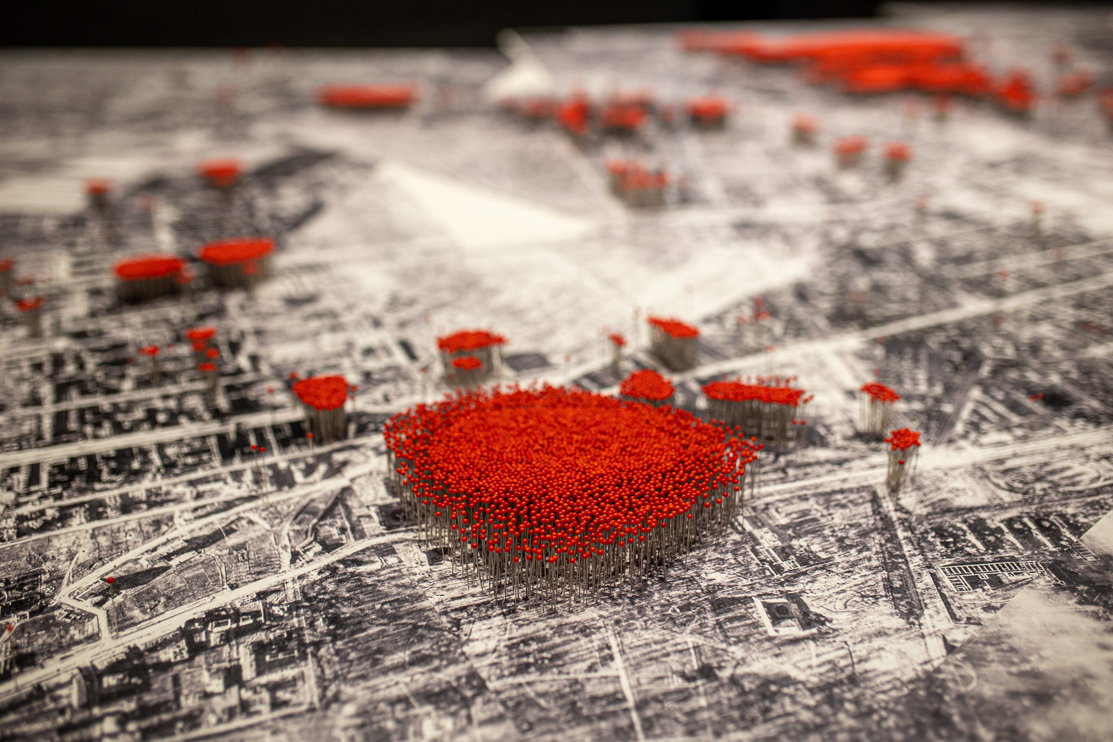
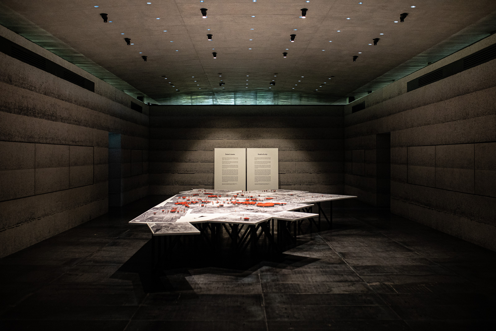
An exposition of makeshift graves and execution sites where the residents of Warsaw as well as insurgents were being shot dead is presented by way of maps showing the city from the bird’s eye view.
The maps have been developed by Zygmunt Walkowski, an expert in Warsaw’s iconography from the period of World War Two who specialises in interpreting photos of the capital city. A pre-war land map of Warsaw was used to determine the locations of events described in historic documents. The places marked on the map were transferred onto the German aerial photographs taken during the Uprising and after its suppression. The photos, kept at the National Archive in College Park near Washington DC, recorded the tragedy of Warsaw, razed to the ground by the Germans after the fall of the Uprising.
fot. Jakub Celej
The maps are accompanied by lists of execution sites which contain information on dates and circumstances of the events as well as on the victims and their subsequent commemoration. The exposition is complemented by a display of approximately 50 photos from the Museum of Warsaw collection which were taken during the Uprising and after the fighting had stopped—they show ruined city, graves amongst the rubble and remains of the victims.
-

- Otwarcie Izby Pamięci przy Cmentarzu Powstańców Warszawy, 2 października 2022 roku, fot. Jakub Celej
-

- Otwarcie Izby Pamięci przy Cmentarzu Powstańców Warszawy, 2 października 2022 roku, fot. Jakub Celej
-
- Otwarcie Izby Pamięci przy Cmentarzu Powstańców Warszawy, 2 października 2022 roku, fot. Jakub Celej
-
- fot. Tomasz Kaczor
-

- fot. Jakub Celej
-

- fot. Jakub Celej